Institute / Practice & Collaboration / Tracing Shancheng Lane
Tracing Shancheng Lane
山城巷寻迹
What it is
A course commission from XAUAT: find the places in Chongqing's Shancheng Lane where people deal with slopes, cliffs and stairs, using public videos, travel notes and social-media posts collected by students, and turn them into an interactive 3D map that opens offline.
Why believe it
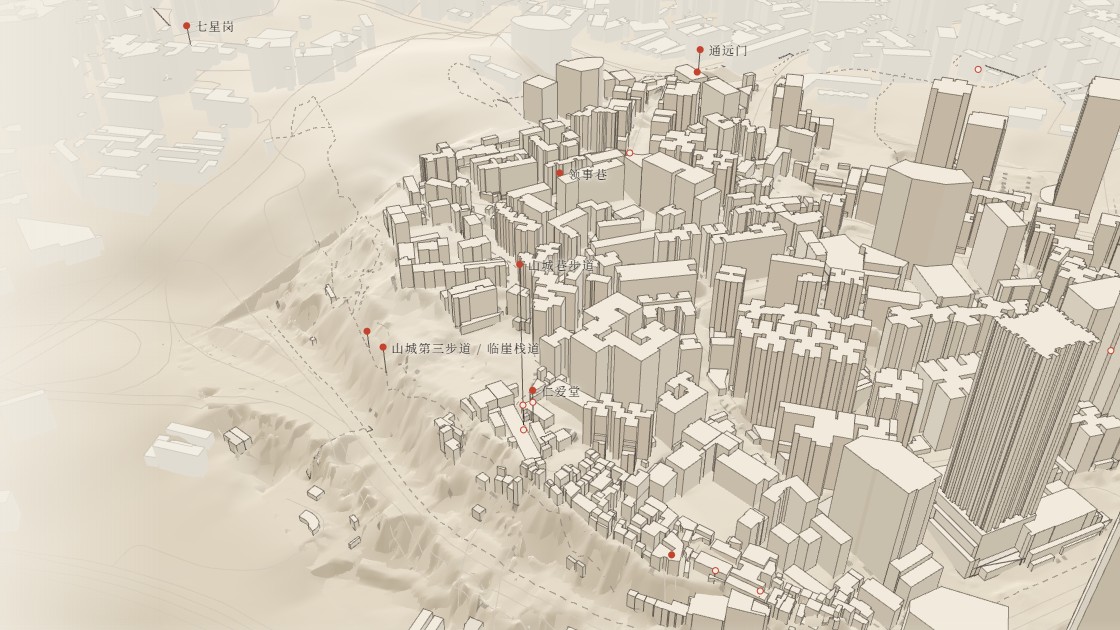
Terrain: FABDEM (CC BY-NC-SA 4.0)
83,437public video texts counted (Bilibili, YouTube)
2026-10-28 · Report
Where it stands
Released2026-10-29 · Release
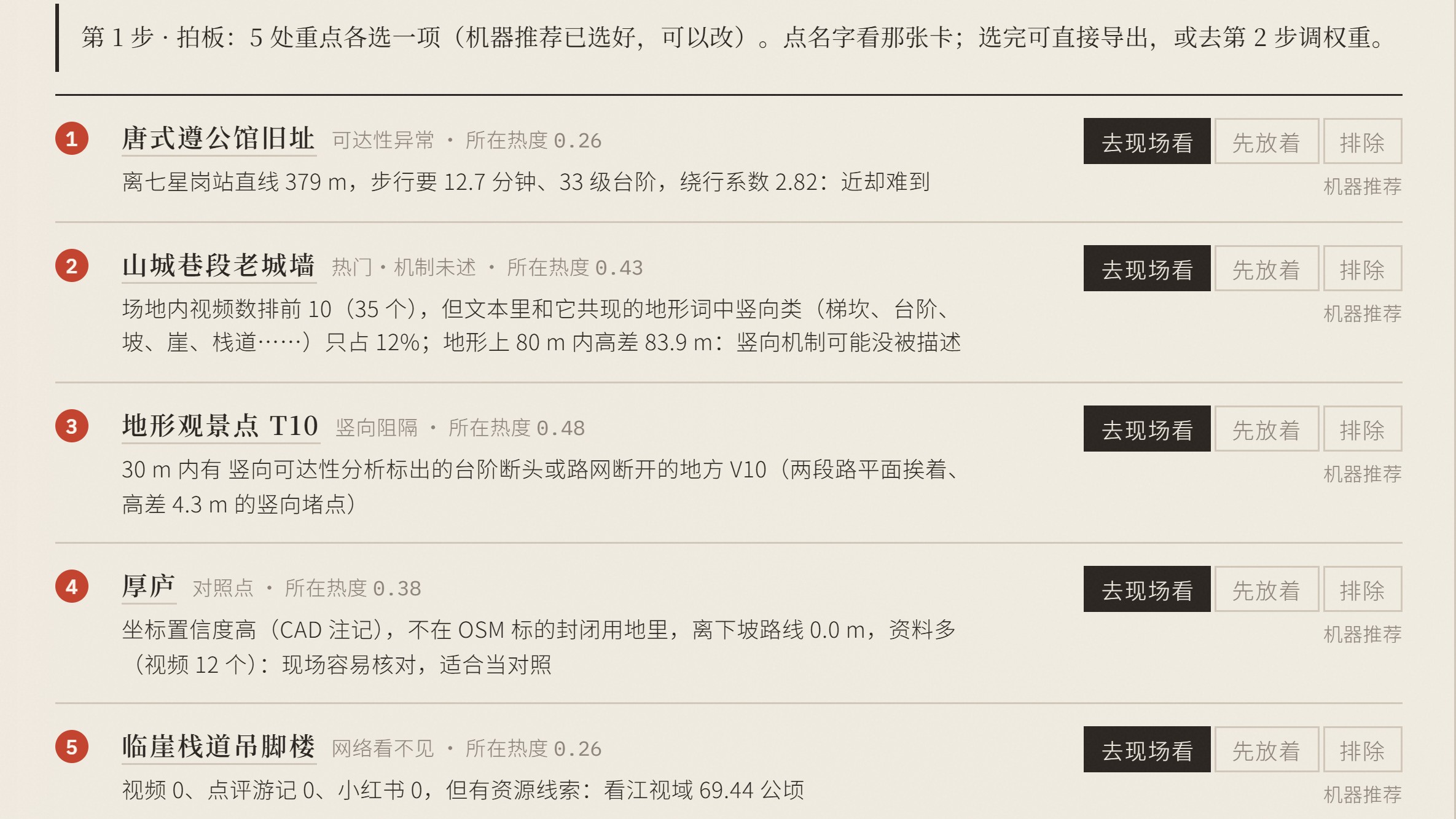
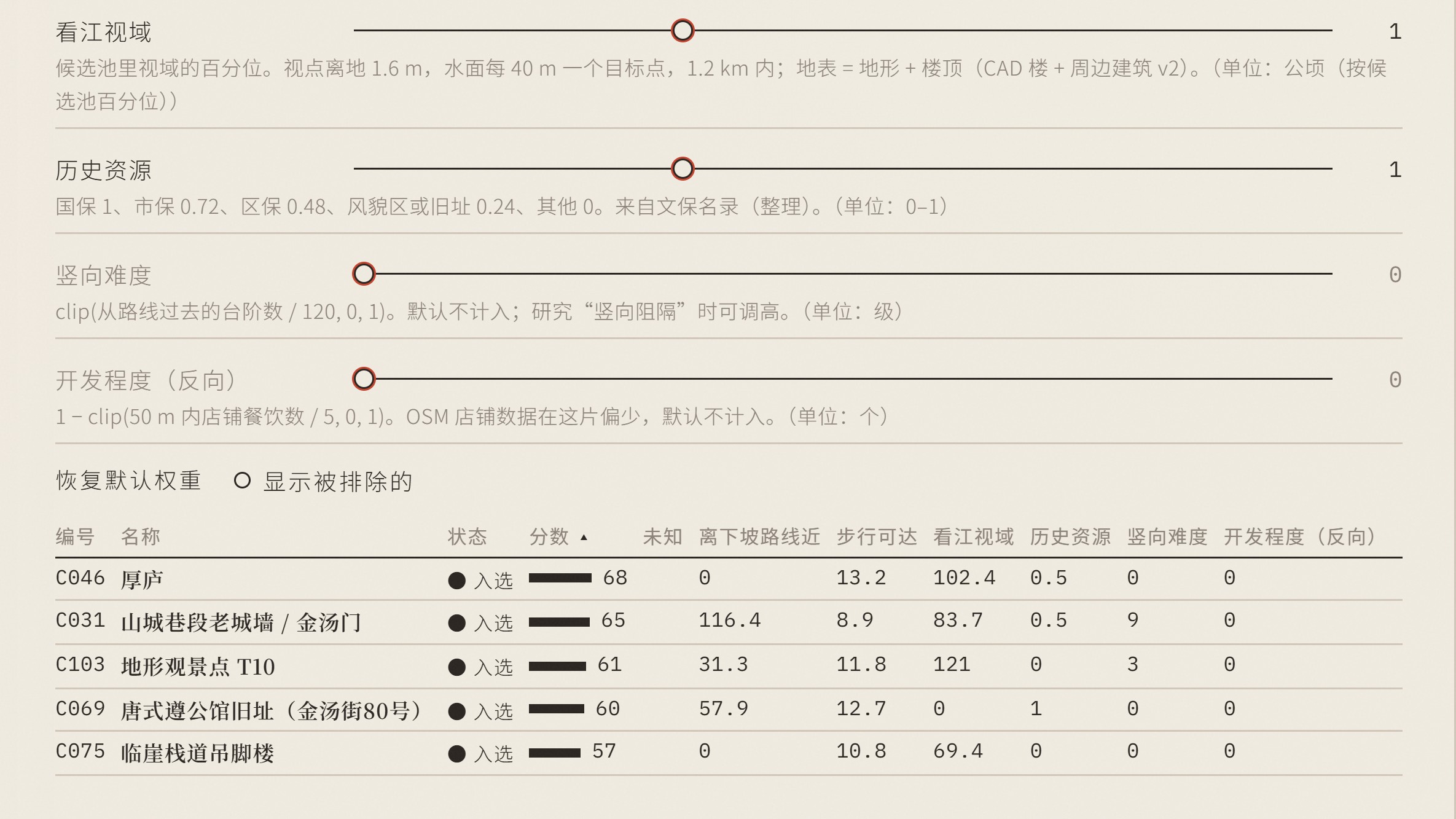
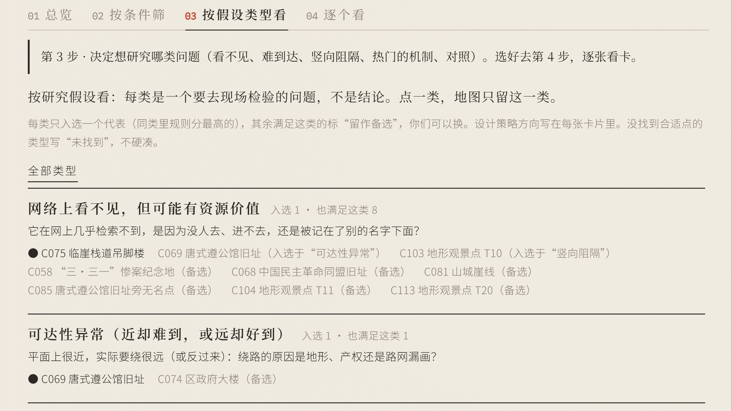
Delivered 1029b: added “overlooked places”; the machine proposed 5 candidate spots as research hypotheses, each with a candidate card and a field for the students' judgment, exportable as feedback.json.
- Titles
- Tracing Shancheng Lane · 山城巷寻迹 / XA-001
- Status
- Released
- People
- leadKaiwen LiuClient liaison and coordination
- collaboratorName withheld until consentXAUAT tracing-group students: set the brief, supplied CAD terrain and social-media posts
- collaboratorName withheld until consentCourse instructor
Key images
Highlights
- 2026-10-27ReportFirst version: 37 check-in spots extracted from 81 public pages and videos, 13 of them matching the official heritage list directly.
- 2026-10-28ReportSample enlarged to 1,849 Bilibili and 462 YouTube videos with 83,437 video texts, plus 487 reviews and travel notes and 2,159 geotagged photos; each source counted separately.
- 2026-10-29ReleaseDelivered 1029b: added “overlooked places”; the machine proposed 5 candidate spots as research hypotheses, each with a candidate card and a field for the students' judgment, exportable as feedback.json.
Drawings, versions and releases
- 2026-10-29ReleaseDelivered 1029b: added “overlooked places”; the machine proposed 5 candidate spots as research hypotheses, each with a candidate card and a field for the students' judgment, exportable as feedback.json.
- Question
- How do visitors to Shancheng Lane deal with slopes, cliffs and stairs? Which places with terrain are overlooked?
- Method
- Extract place names from public sources and match coordinates; classify them by how people interact with the terrain; rank by number of mentions, counting each source separately; overlay GIS layers and the students' CAD. The machine proposes candidate spots and students judge them on site.
- Claims
In the first version, 13 of the 37 check-in spots matched the official heritage list directly. (ev-03)
- Limitations
- Breaks, vertical blockages and buildings meeting the ground at several levels still need checking on site; sources are counted separately, not added up.
- Research lines
- design-education
Failures and superseded routes
- 2026-10-28FailureMonkeyHub could not make the interactive 3D map (the Board has no coordinate system and does not read GeoJSON, GeoTIFF or DXF), so a web page was used this time and the gap went into the requirements register.
- 2026-10-27FailureThe first version could not get content from Xiaohongshu, Douyin, Weibo or Zhihu: search engines found no public pages, and opening them directly gave empty pages or verification prompts. Students collected it with their own accounts instead.
Releases and tests
- 2026-10-29ReleaseDelivered 1029b: added “overlooked places”; the machine proposed 5 candidate spots as research hypotheses, each with a candidate card and a field for the students' judgment, exportable as feedback.json.
Evidence chain · 8 records
- 2026-10-23DecisionKaiwen decided not to teach at XAUAT and to take on a student commission instead, which doubles as user research for MonkeyHub.
- 2026-10-27DecisionTook on XA-001: the tracing group wanted AI to find check-in spots in Shancheng Lane where people deal with slopes, cliffs and stairs, along with historic landscape resources; a server session started on the public-source part the same day.
- 2026-10-27ReportFirst version: 37 check-in spots extracted from 81 public pages and videos, 13 of them matching the official heritage list directly.
- 2026-10-27ReportGIS overlay: ten OSM layers, slope, kernel density of mentions, and river view lines.
- 2026-10-27FailureThe first version could not get content from Xiaohongshu, Douyin, Weibo or Zhihu: search engines found no public pages, and opening them directly gave empty pages or verification prompts. Students collected it with their own accounts instead.
- 2026-10-28ReportSample enlarged to 1,849 Bilibili and 462 YouTube videos with 83,437 video texts, plus 487 reviews and travel notes and 2,159 geotagged photos; each source counted separately.
- 2026-10-28FailureMonkeyHub could not make the interactive 3D map (the Board has no coordinate system and does not read GeoJSON, GeoTIFF or DXF), so a web page was used this time and the gap went into the requirements register.
- 2026-10-29ReleaseDelivered 1029b: added “overlooked places”; the machine proposed 5 candidate spots as research hypotheses, each with a candidate card and a field for the students' judgment, exportable as feedback.json.